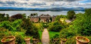
This loop walk leads you from picturesque Carriganass Castle in Kealkill up into the West Cork hills, with wonderful views across Bantry Bay.
It’s name ‘Srón na Gaoithe’ means ‘nose of the wind’, but hopefully you’ll have fine weather on the day you walk!
From the entrance of Carriganass Castle follow the road to the left past the picnic area. After 0.5 km, you will cross a bridge over the Owenbeg River.
At the junction beyond the bridge, follow the right fork, gradually ascending into the foothills above you.
After about 2.5km, you’ll see a stile on your left. Leave the roadway, and cross the stile. Follow the way markers along the new plantation track which ascends sharply as it brings you to the crest of the hill of Knockbreteen.
From the top of the hill, follow the way markers west alongside the fence. Be careful here on the rough terrain.
Watch out for the small stile, and use it to cross to the other side of the fence.
This spot offers panoramic views across the three valleys which surround Carriganass Castle. See Cnoc Baoi – the highest peak in County Cork to the north – and Bantry to the west.
Follow the markers until there is a dip in the ridge, and then turn to the north and descend the steep firebreak over boggy wet ground to a stile.
Cross the stile to reach the Maugha Road.
Cnoc an Air (the Hill of Slaughter) can be seen across the valley.
At the roadway, follow the sign to the left for 0.4km to reach the Maughanasilly crossroads.
Immediately east of the crossroads, visit the Bronze Age Stone Row on the left. For a more contemporary diversion, call in to the basketry workshop and organic farm 150 metres to the north.
To head back to Carriganass Castle from here, follow the signs and roadway that take you around the lake. The signs lead you past the quarry which was the source of the original stone for Carriganass Castle.
To extend the walk for another hour, you can link into the Póc an Tairbh loop walk at the crossroads.

