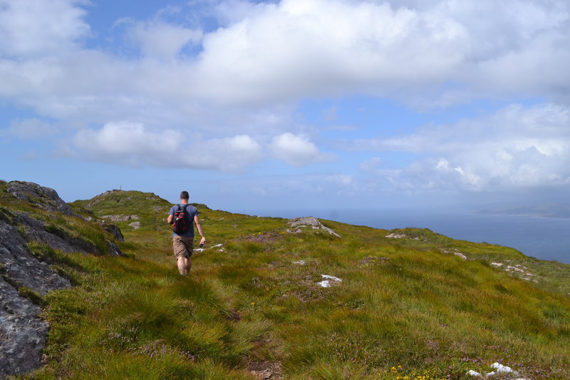
The Seefin loop walk leads you out along the ridge of the Sheep’s Head with spectacular views over Bantry Bay, Dunmanus Bay, and the ridge of the peninsula
The route climbs up to the ridge of the peninsula, and rewards you as you walk with views over Kilcrohane, our West Cork bays, the Mizen and Beara peninsulas and the West Cork islands in Bantry and Roaringwater bays.
The chance to reward yourself with a fine feast, or a drink overlooking Kitchen Cove at Ahakista‘s Arundel’s By the Pier isn’t to be missed at the end of your journey.
Seefin Loop Walk Details
From the car park at Arundel’s by the Pier, take a right onto the public road and continue on until you arrive at a tee junction (Ahakista Bridge).
Take a right here and then the first left as per the finger post sign and follow the blue arrows for Seefin. At the next finger post sign keep left and follow the blue arrows for Seefin in a northwesterly direction and at way marker no. 9 (Seefin) continue straight on along the track.
When you arrive at way marker no. 10 for Seefin take a left and follow the blue arrows in a southwesterly direction until you reach way marker no. 21 for Seefin. Take a right here and continue on in a northerly direction.
At The Windy Gap Junction sign (way marker no. 165) take the Seefin/Kilcrohane option keeping left in a southwesterly direction for the summit of Seefin. When you reach the top take a sharp left at the Trig Point/way marker no. 41.
Descend following the blue arrows and continue through to a farmyard. At way marker no. 64 you will go off road and then pass an old “Cillín” (little church or burial ground) and a fort on your way. At way marker no. 76 continue on down until you reach way marker no. 92 on the old Kilcrohane/Ahakista road. Take a left here and continue straight on along the old road.
You will eventually arrive onto a tarred road, passing by the Átha Thomáis memorial em route to the main public road. This will lead you back to Ahakista bridge and the car park at Arundel’s by the Pier.
| Download GPX Files for GPS Devices: | Download Seefin Loop Walk GPX file |
| Download File for 3D View in Google Earth: | Download Seefin Loop Walk KMZ file |
| Start/Finish: | Ahakista Trailhead: Arundels by the Pier car park. |
| Grade: | Hard |
| Distance: | 12.1 km (approx) |
| Estimated Time: | 4hrs 15 mins (based on average walking speed of 3km per hour) |
| Arrows: | Blue |
| Metres Climbed/ Ascent: | 475 metres |
| Maximum Height: | 345 metres |
| Dogs Allowed? | No |
| Minimum Gear: | Walking boots, rain gear, fluid, and a mobile phone. |


