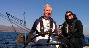
The third stretch of the Sheep’s Head Way walk on the spectacular Sheep’s Head peninsula leads you from Glanlough to Seefin via Gortnakilly, or by the Seefin ridge route
Distance: 11km / 4hrs
Sheep’s Head Way section 3 is also part of the Glanlough Loop. It climbs slowly up to the ridge that runs down the length of the Sheep’s Head peninsula. It follows that ridge, with fine views over Dunmanus and Bantry bays, before descending to the low saddle where it crosses the Mass Path at Maulnaskehy.
Section 3 then climbs again, going slightly to the north to the aptly named ‘Windy Gap’. The ‘official’ Sheep’s Head Way main route descends by a track, extended and improved in 2011, to Gortnakilly. A road section leads west from there via the ‘Goat’s Path’ to the ridge below Seefin and Finn McCool’s Seat.
An alternative route is signposted at Windy Gap, following the main ridge to the summit of Seefin.
Windy Gap is a crossroads on the Sheep’s Head Way with several of the loop routes crossing near here.
The Sheep’s Head Way section 3 route is characterised by several ‘kinks’ where geological faults have shifted the peninsula south. At these points, it is important to follow the posts to avoid small cliffs.
IV 89148 43042
From the parking area turn right, downhill and then left at the first junction. Follow the road, taking the right fork.
IV 889 438
The path leaves the road up a track which soon becomes less distinct. At some places, the next post is difficult to spot so keep an eye on the path. After a short climb, look back to see Glanlough.
IV 876 425
Here, Dunmanus Bay comes into view, and you are on top of the world!
In clear weather, the Fastnet rock can be seen across the Mizen. Keep to the path and stay on rocky ground, as there are bog holes between posts 111 and 112.
IV 871 422
At marker 117, the path kinks to the left to avoid a cliff. There are several similar places on this route. Don’t be tempted to head straight for the post across the valley, unless you have wings!
IV 850 417
The Mass Path crosses this route at marker 151: it was traditionally used by people on the north side on their way to mass. Down to the left is Ahakista, and to the North Doonour. This path gives access to both sides of the peninsula if you decide to shorten your walk here.
IV 82913 41167
The route joins the ‘Goat’s Path’ road (marker 190). Turn left (west) and follow the road for 2.6km to the top. A detour is possible down to Gortnakilly pier (signposted) which is very beautiful.
IV 812 395
The route leads off down the ‘Horseshoe Road’ at marker 195, but do continue a short distance to the top of the Goat’s Path where there are good views and picnic tables if you need a rest. Kilcrohane is down the road to the south and the Peakeen Ridge walk leads off from behind the Marian statue.
Alternative routes
At 151 this route crosses the Mass Path giving access to both sides of the peninsula.
At 169, there is the option to walk to the end of this section along the ridge via Seefin (arguably the best option). There is a short link taking you to the Seefin Loop and after the summit of Seefin, there is a descent to Finn McCool’s Seat, or down the south side of Seefin, taking you to the Sheep’s HEad Way South, and a possible long loop back to Glanlough.


