Hike along coastal tracks and boreens on Sheep’s Head Way Section 7, taking optional headland routes, en route to the picturesque village of Kilcrohane
Section: Distance: 8.1km
From the main road down to Trá Ruiam, through coastal fields, boreens, and tracks to Dooneen. Then a stretch of road-walking before turning back down to the coast, over a pebble beach and through fields to Kilcrohane. The route passes a small ring fort, cillin (burial ground) and prehistoric stone alignment. Extra headland loops are available,, and clearly signposted, at Reen and Dooneen.
IV 78037 35949
After 350 metres, the route turns right, signed ‘Trá Ruiam’. Follow the road steeply downhill through several hairpin bends (it can be slippery here if cattle have recently passed by!). As you go down the hill, a small ring fort can be seen in a field near the coast. At the bottom of the hill you’ll find the beach and quay where fishing nets and ropes were treated with the bark of the alder. If you want to take the loop around Reen headland, walk past the beach and over the bridge.
At marker 360 (IV 78288 35566), the main route turns left into a field and then after a bridge and stile over a wall, skirts around a house and crosses another field before joining a small road.
This route takes you past the Caher burial ground (IV 78828 35897).
At marker 368 (V 78997 36018), in front of a house, turn right and follow the road downhill. After 110m, turn left onto a boreen that winds its way down to the coast at Dooneen. Where the path meets the road at 378. After a ladder stile, turn right if you want to explore Dooneen headland and quay, or left to continue to Kilcrohane.
The route joins the main road again where you turn right. You now have a road walk of 1.4km – there is a fine ring fort (Ardahill)to your left at the top of a low hill below Seefin and the ridge between Barán and Roskerrig is ahead of you in the distance.
382 (IV 81294 37373)
The route turns right off the road over a cattle grid and down a farm track. Before reaching the farm buildings, turn left into a field and head for a low wall under some Monterey Pines (384), then down to the strand. You cross a stream (can be wider than a stride in wet weather!) and along the top of the pebbly beach. At high tide, and/or in wet weather, another stream has to be crossed before you go over the headland and turn left into a field. Keep to the edge and eventually climb over a stile that brings you out onto a small road.
IV 82065 36995
After you pass some houses at ‘Paddock’, the route leaves the road and turns left up a small boreen. This boreen ends up in the back garden of a house (you aren’t trespassing!) where you cross diagonally over the lawn and close to the side of the house before crossing a stone flag bridge over a stream onto a road. Go straight across the road and through the double gates of a house garage entrance.
The path can be found in the corner, just past the garage and it takes you past some old farm buildings. (At the road, you can also turn to the right to visit the old Kilcrohane church and graveyard, and then return.)
IV 82110 37350
After a gate at marker 400, look to the right to see two standing stones. Follow the path that goes between fences across a field (this is the old ‘funeral path’ from the village to the graveyard) and then turns right along a field boundary before going up over the field wall and across some rough ground to join the public road at 403 where you turn left.
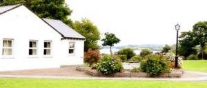
The road takes you up into the village of Kilcrohane where, after turning right, there is a shop and post Office and two pubs to choose from. The village is also home to the Sheep’s Head Producers’ Shop which is run by local craftspeople and artisan food producers.
The Old Creamery is a lovely café and restaurant here, and walking groups are welcome (booking in advance is advisable for larger groups).
Continue straight through the village to join the next section of the Sheep’s Head Way.
Alternative Routes
From Letter West, instead of turning down towards Trá Ruiam, you can continue a little further and take the Caher Loop. This will eventually join the main route again.
From Kilcrohane, you can turn left in the village, before the church, and go up to the top of the Goat’s Path road from where you can get to the top of Seefin. From there you can descend again on the Seefin Loop down the south side of the mountain and join the main route at waymarker 383, or continue east along the ridge and descend to Ahakista by the Seefin/Barán loop route or Maulnaskeha Mass Path.