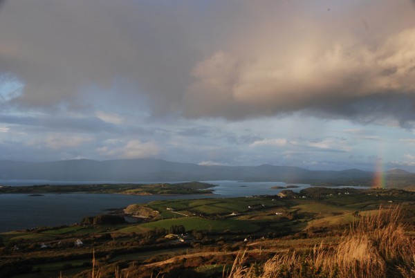
Starting in the heart of Bantry town, the Rooska Loop Walk takes you out into the West Cork countryside where spectacular views await
The route passes Bantry House, ringforts, ruined farms, and a holy well. The views out over Bantry Bay and Whiddy Island are lovely to behold. From the bustle of Bantry square to the green trails of the Sheep’s Head peninsula, this is an absorbing and satisfying West Cork walk.
Rooska Loop Walk Details
To complete the Rooska Loop Walk, set out from the Bantry West trailhead, set out along the N71 and, at way marker no. 1, turn left and continue along until stone way marker no. 678 (on back of stone) and turn right taking the north option.
When you reach the N71 again keep left and continue on again for a short distance until you go off road at way marker no. 4. When you arrive again onto the N71, take the option for ‘Dromclogh’ at the finger post sign (way marker no. 5) after crossing the road.
Continue on along the road again until way marker no. 6 and turn left off the road. You will stay off road until way marker no. 22. Follow the road along until way marker no. 25 and turn left. Continue on up the road, and at the T-junction, take a right as per the finger post sign for Boolteenagh, way marker no. 26.
Continue along until you reach the car park at Boolteenagh. At way marker no. 31 set out off road in a southwesterly direction along the ridge passing Lough Na Fuilla (Lake of the Blood) on your left before you reach way marker no. 49. Turn right here and follow a track (the old lake road) in a northwesterly direction which will eventually lead onto a tarred road at way marker no. 2.
Continue down along the road until it meets the main public road at way marker no. 1 (the finger post sign for Lough na Fuilla and Rooska West) and turn right. Keep along the main road until you reach way marker no. 25 to complete the loop.
From here on follow the way markers back to where you came from and you will eventually arrive at the Bantry West trailhead.
The Rooska Loop Walk is one of 20 colour-coded Sheep’s Head Way loop walks.
| GPX File for GPS: | Download GPX file for Rooska Loop Walk |
| View 3D in Google Earth: | Download KMZ file for Rooska Loop Walk |
| Start/Finish: | Bantry West Trailhead |
| Grade: | Moderate |
| Distance: | 13.9 km (approx) |
| Estimated time: | 4 hours 45 mins (based on average walking speed of 3 km per hour) |
| Arrows: | Purple |
| Metres Climbed/ Ascent: | 433 metres |
| Maximum Height: | 222 metres |
| Dogs Allowed? | No |
| Minimum Gear: | Walking boots, rain gear, fluid, and a mobile phone. |


