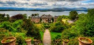
The stunning walk that forms Sheep’s Head Way section 5 leads from Cahergal via The Crimea and Copper Mines to The Cove and then to the Lighthouse at the end of the Sheep’s Head peninsula.
Distance: 8km
The Sheep’s Head Way section 5 route passes through interesting historical areas and beautiful coastal scenery with high cliffs.
IV 76839 37719
The area you pass through is known as ‘The Crimea’ (pronounced ‘cra-may’) for reasons explained here. There are several ruined dwellings and the old field enclosures can be seen below. The path winds around the buildings.
At Post 220 (IV 76405 37420) the path descends towards a pond which was part of the local copper mine workings. There are several open (fenced) shafts here. The path then crosses a narrow rock ledge – it looks worse than it is at first and there is a helpful hand rail – but don’t look down if you suffer from vertigo! Looking back, you can see some of the mine adits in the cliff face.
Just before Post 222 (IV 76207 37298) you’ll find a terrace of cottages that were occupied by the miners. The mine was worked between 1840-90. An image of the mine workings at Gortnavallig can be seen here.
The path climbs to the crest of the low ridge from where you look down to The Cove. The Cove is a small slip surrounded by low rocky cliffs. At the top if the slip is a memorial to the author JG Farrell who tragically drowned here in 1979.
From here, follow the track uphill.
At marker 235 (IV 76372 36557), turn right off the road. The path goes up between two field walls.
Turn right to follow the road at 238, and then fork right onto a farm track below the house.
IV 74315 35395
A beautiful cove with a waterfall can be seen at marker 258.
At 278m, ‘Daingean’, the Lighthouse loop joins from the south. Continue straight ahead.
The route heads uphill. To go to the lighthouse, continue to the right, past the storage container and go down the steps.
IV 71814 33819
The small lighthouse at the end of the peninsula was built in 1968 to help guide in the oil tankers that were to use the new oil terminal on Whiddy Island. It marks the southern tip of Bantry Bay.
Because of the remoteness of the peninsula, and the lack of a road to its tip, the building materials and equipment for the lighthouse were lifted from Kilcrohane, 9km away, by helicopter and about 250 lifts were needed.
When the construction of the lighthouse and the long flight of steps leading up to it was completed, the helicopter was again used to lift the lantern, optic, standby engine and control gear to the lighthouse which was put into operation for the first time on 14th October 1968.
From the end of the peninsula, you are afforded spectacular views across the Bay and the two neighbouring peninsulas: the Mizen and the Beara.


