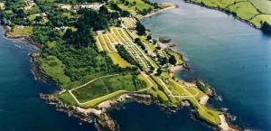
The eastwards section of the Sheep’s Head Way walking route starts above the lighthouse near the little landing circle
The Sheep’s Head Way Section 6broute follows the well-worn path up to the Sheep’s Head Café (Bernie’s Cupán Tae) and Tooreen parking area.
(IV 71814 33819)
Far below the landing circle is the ‘ÉIRE’ sign placed here to remind pilots of Ireland’s neutrality in the second world war war. It’s difficult to see on the ground but can be made out on the Google satellite map by zooming in. Shortly after you have started the walk, it’s worth pausing to take a (careful!) look at the cliffs after the path crosses a bridge and some boggy ground.
After the Sheep’s Head Café, the path can be found just behind the toilet building. It climbs quickly and there are good views westwards over the field systems below the houses half way down the cliff. You pass a small lookout post called ‘The Camp’, another relic from the second world war, known as The Emergency’in Ireland.
Soon after is an Ordnance Survey trig point – a concrete triangulation point marking a hill’s highest spot – and you’ll be able to take in views over small loughs and, to the north side of the peninsula, Bantry Bay and the Beara peninsula.
IV 74274 34345
The 17th Century Signal Tower finally blew down in 1990. From there the old road, built to service the tower begins and descends to Fail Bheag where you cross the road by turning left and then right shortly after. You pass two more loughs before the path passes a house.
At marker 353 (IV 77597 35929), the path turns right and over a stone stile into a field. You then descend to the road and turn left towards Letter West near the village of Kilcrohane or continue on to the next section of the walking route.


