Living the Sheep's Head Way

  • The Sheep’s Head Way
  • Loop Walks
  • Accommodation
    • B&Bs
    • Hotels
    • Farmhouse Accommodation
    • Campsites

MENUMENU
  • Home
  • Things to Do
    • Walking
      • Sheep's Head Way Main Route
      • Loop Walks
        • Difficulty
          • Easy
          • Moderate
          • Hard
        • Time
          • Under 3 hours
          • 3-5 hours
          • 5 hours or more
        • Trailheads
          • Ahakista
          • Bantry West
          • Black Gate
          • Dún Óir
          • Durrus
          • Goat's Path
          • Kilcrohane
          • Tooreen
          • Whiddy Island
      • Walking Guides
    • Courses & Training
    • Crafts
    • Culture
    • Gardens
    • History
    • Cycling
    • Pony Trekking
    • Sailing & Kayaking
  • What's On
    • Events
    • Scheduled Courses
    • Festivals
  • Food
    • Cafés
    • Restaurants
    • Food Producers
    • Food Tours
    • Coeliac-Friendly
  • Where to Stay
    • B&B
    • Hotels
    • Self-Catering Holiday Homes
    • Farmhouse Accommodation
    • Campsites
    • Luxury Accommodation
    • Accessible Accommodation
  • News
  • How to Get Here
  • Location
    • Map
    • Ahakista
    • Bantry
    • Ballylickey
    • Drimoleague
    • Durrus
    • Kilcrohane
    • Whiddy Island
  • Services
    • Shops
    • Taxi Services
  • Contact Us
You are here: Home / Archives for Sheep's Head Way

Sheep’s Head Way Section 6: Lighthouse to Letter West

January 18, 2014 by Dunmanus

The eastwards section of the Sheep’s Head Way walking route starts above the lighthouse near the little landing circle

The Sheep’s Head Way Section 6broute follows the well-worn path up to the Sheep’s Head Café (Bernie’s Cupán Tae) and Tooreen parking area.

(IV 71814 33819)

Far below the landing circle is the ‘ÉIRE’ sign placed here to remind pilots of Ireland’s neutrality in the second world war war. It’s difficult to see on the ground but can be made out on the Google satellite map by zooming in. Shortly after you have started the walk, it’s worth pausing to take a (careful!) look at the cliffs after the path crosses a bridge and some boggy ground.

After the Sheep’s Head Café, the path can be found just behind the toilet building. It climbs quickly and there are good views westwards over the field systems below the houses half way down the cliff. You pass a small lookout post called ‘The Camp’, another relic from the second world war, known as The Emergency’in Ireland.

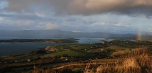
Soon after is an Ordnance Survey trig point – a concrete triangulation point marking a hill’s highest spot – and you’ll be able to take in views over small loughs and, to the north side of the peninsula, Bantry Bay and the Beara peninsula.

IV 74274 34345
The 17th Century Signal Tower finally blew down in 1990. From there the old road, built to service the tower begins and descends to Fail Bheag where you cross the road by turning left and then right shortly after. You pass two more loughs before the path passes a house.

At marker 353 (IV 77597 35929), the path turns right and over a stone stile into a field. You then descend to the road and turn left towards Letter West near the village of Kilcrohane or continue on to the next section of the walking route.
Filed Under: Sheep's Head Way, Walking

Sheep’s Head Way Section 7: Letter West to Kilcrohane

January 18, 2014 by Dunmanus

Hike along coastal tracks and boreens on Sheep’s Head Way Section 7, taking optional headland routes, en route to the picturesque village of Kilcrohane

Section: Distance: 8.1km

From the main road down to Trá Ruiam, through coastal fields, boreens, and tracks to Dooneen. Then a stretch of road-walking before turning back down to the coast, over a pebble beach and through fields to Kilcrohane. The route passes a small ring fort, cillin (burial ground) and prehistoric stone alignment. Extra headland loops are available,, and clearly signposted, at Reen and Dooneen.

IV 78037 35949
After 350 metres, the route turns right, signed ‘Trá Ruiam’. Follow the road steeply downhill through several hairpin bends (it can be slippery here if cattle have recently passed by!). As you go down the hill, a small ring fort can be seen in a field near the coast. At the bottom of the hill you’ll find the beach and quay where fishing nets and ropes were treated with the bark of the alder. If you want to take the loop around Reen headland, walk past the beach and over the bridge.

At marker 360 (IV 78288 35566), the main route turns left into a field and then after a bridge and stile over a wall, skirts around a house and crosses another field before joining a small road.

This route takes you past the Caher burial ground (IV 78828 35897).

At marker 368 (V 78997 36018), in front of a house, turn right and follow the road downhill. After 110m, turn left onto a boreen that winds its way down to the coast at Dooneen. Where the path meets the road at 378. After a ladder stile, turn right if you want to explore Dooneen headland and quay, or left to continue to Kilcrohane.

The route joins the main road again where you turn right. You now have a road walk of 1.4km – there is a fine ring fort (Ardahill)to your left at the top of a low hill below Seefin and the ridge between Barán and Roskerrig is ahead of you in the distance.

382 (IV 81294 37373)
The route turns right off the road over a cattle grid and down a farm track. Before reaching the farm buildings, turn left into a field and head for a low wall under some Monterey Pines (384), then down to the strand. You cross a stream (can be wider than a stride in wet weather!) and along the top of the pebbly beach. At high tide, and/or in wet weather, another stream has to be crossed before you go over the headland and turn left into a field. Keep to the edge and eventually climb over a stile that brings you out onto a small road.

IV 82065 36995
After you pass some houses at ‘Paddock’, the route leaves the road and turns left up a small boreen. This boreen ends up in the back garden of a house (you aren’t trespassing!) where you cross diagonally over the lawn and close to the side of the house before crossing a stone flag bridge over a stream onto a road. Go straight across the road and through the double gates of a house garage entrance.

The path can be found in the corner, just past the garage and it takes you past some old farm buildings. (At the road, you can also turn to the right to visit the old Kilcrohane church and graveyard, and then return.)

IV 82110 37350

After a gate at marker 400, look to the right to see two standing stones. Follow the path that goes between fences across a field (this is the old ‘funeral path’ from the village to the graveyard) and then turns right along a field boundary before going up over the field wall and across some rough ground to join the public road at 403 where you turn left.

The road takes you up into the village of Kilcrohane where, after turning right, there is a shop and post Office and two pubs to choose from. The village is also home to the Sheep’s Head Producers’ Shop which is run by local craftspeople and artisan food producers.

The Old Creamery is a lovely café and restaurant here, and walking groups are welcome (booking in advance is advisable for larger groups).

Continue straight through the village to join the next section of the Sheep’s Head Way.

Alternative Routes

From Letter West, instead of turning down towards Trá Ruiam, you can continue a little further and take the Caher Loop. This will eventually join the main route again.

From Kilcrohane, you can turn left in the village, before the church, and go up to the top of the Goat’s Path road from where you can get to the top of Seefin. From there you can descend again on the Seefin Loop down the south side of the mountain and join the main route at waymarker 383, or continue east along the ridge and descend to Ahakista by the Seefin/Barán loop route or Maulnaskeha Mass Path.

Filed Under: Sheep's Head Way, Walking

Sheep’s Head Way Section 8: Kilcrohane to Ahakista

January 18, 2014 by Dunmanus

Hike from the village of Kilcrohane to the coast at Farranamanagh and on, via ‘the old road’, to Ahakista.

Sheep’s Head Way Section 8 Distance: 6.5km (4.07 miles)

IV 81988 37807
The Sheep’s Head Way Section 8 route follows the main road out of the village of Kilcrohane on the Sheep’s Head peninsula. The left turn by the church takes you to the top of the Goat’s Path (Finn McCool’s Seat), and Seefin.

404 (V 824 379)
0.5km east from Kilcrohane the path turns right off the main road over a stone stile into a field. Keep to the field boundary and then over a high wall with steps. Across a couple of fields, you join a small boreen which takes to down to the wide bay of Farranamanagh.

409
IV 82777 37676
Where the boreen meets the coast is Cois Cuain – a garden with many exotic plants. The path goes between the sea and Farranamanagh Lake and then climbs up the headland after crossing a stone flag bridge.

Site of Bardic School
IV 83678 37900
The site of a Bardic School. You may wish to stop and compose a poem of your own? If not, continue on to where the path crosses the road at the Dromnea parking area.

IV 83643 38087
Cross over the road and follow the path over a stone stile to the Poet’s Well – a recently restored holy well. Over the stone stile, the path turns to the right along the old road between Kilcrohane and Ahakista. At 430 is the junction with the Seefin Loop.

Marker 440 (IV 85219 39107) marks a junction with the Barán Loop Walk.

After the old green road becomes a track and then a road (403, IV 85871 39381) you arrive at Hillcrest B&B. You can take a short diversion here to visit the Roskerrig burial ground and then continue down the hill towards Ahakista.

At marker 444 (IV 86096 39533) there is a memorial to the late Tom Whitty who was instrumental in creating the Sheep’s Head Way walking route. He truly deserves your thanks as you pause for a moment.

From here, walk up the path to the Gorteanish stone circle. Then continue on across some rough ground until you cross a stone stile at 459 (IV 86376 40161) onto a road and turn right, downhill.

After 330 meters (462), the next section of the route leaves the road to the left over another stone stile and begins to climb uphill. If you are breaking your journey here, continue down the road into Ahakista (IV 86932 39800).

Alternative routes to Ahakista

From Kilcrohane, you can choose to walk up to Seefin to join the Seefin Loop, or from post 430 up the south side of Seefin, or from post 440, up Roskerrig on the Barán Loop. All of these routes can be used to get up to the ridge before descending to Ahakista where you’ll find pubs the restaurant at Arundel’s By The Pier with its great views across Kitchen Cove, and Heron Gallery Café and Gardens (seasonal): all fine places to relax!

Filed Under: Sheep's Head Way, Walking

Sheep’s Head Way Section 9: Ahakista to Durrus

January 18, 2014 by Dunmanus

From the quiet seaside village of Ahakista, walk the Sheep’s Head Way Section 9 to Durrus

The route takes you via a low ridge, across open land and then through fields, tracks and boreens to Durrus village at the head of Dunmanus Bay. It’s the gateway to the Mizen and Sheep’s Head peninsulas.

Distance: 12km (7.4 miles)

This route climbs to a low ridge from above Ahakista and then descends to a short road section before crossing open land to Brahalish. After another road section, it crosses over a ring fort and then crosses fields, tracks and short road sections. After passing a fortified manor house it joins the road again and enters the village of Durrus.

462 IV 86665 40082
This section starts where the path turns off the road (462 IV 86665 40082). It heads up to a low ridge where there are two small lakes. It then descends towards a small road at 483 which you follow down to the next junction.

488
IV 87954 40626
Turn left at the road junction, and then left again at the next.

490
IV 88320 41231
After 500 metres, the path turns right off the road and goes across open land towards the low ridge.

At 498 (IV 89079 41538) the path turns left onto a track which passes lakes. A fine view towards Durrus is available here.

512 Brahalish
Turn right onto the road. The Glanlough route joins the route you have just walked from the left.

516-517 Brahalish ring fort
IV 90408 42578
At 516, turn right off the road over a stone stile and at 517 you come to Brahalish ring fort. This is an impressive example and is in a good state of preservation.

After crossing the fort, the path heads for the corner of the field. It then turns to the left, goes through a gate into another field and joins the road again. Shortly after at 524 (IV 90560 42280) the path turns off to the left onto a track. crosses some fields and then joins the road again at 530 (IV 90550 41944).

At 532 (IV 90648 41837) the path leaves the road again and heads off across fields and at 536 (IV 90942 41861) there is a cillín – a little churchyard – hidden in trees just down a farm track.

550
IV 91663 42044
Turn right onto a track and follow it to where it joins the road at 553 (IV 92083 41916). Turn left onto the road and then, at 554 (IV 92460 41988), leave the road again over a stone stile under some trees in the corner of a field.

558 Fortified House
IV 92884 42118
Cul na Long – Nook of the Ships – is a seventeenth century fortified manor house. It is now in a sad state of repair, but very atmospheric. The track here is thought to be part of the old road that once ran down the Sheep’s Head peninsula to the signal tower. At the end of this tree-lined track, turn left onto the road at 560 (IV 93268 41964) and follow it down to St. James’ Church where you go through the church-yard and turn left onto the main road which you follow into Durrus (94653 42044).

Alternative routes

At 512 you can take a left turn to join the Glanlough Loop and follow it (in reverse) back to Ahakista.
At 562, instead of heading through St. James churchyard, you can turn left and follow the road past St. James’ School and up through Coomkeen (home of Durrus Cheese and Cronin’s Forge) for 4km to Boolteenagh where you can join the Sheep’s Head Way North and either go into Bantry, or back towards Ahakista via Glanlough. Do check your map carefully, as this is not a shortcut by any means!

Filed Under: Sheep's Head Way, Walking

Sheep’s Head Way Section 10: Durrus to Barnageehy

January 18, 2014 by Dunmanus

Enjoy fabulous views as you walk the Sheep’s Head Way from Durrus village at the head of Dunmanus Bay to Barnageehy via Glan Lough

Distance: 3hrs, 10km

From Durrus village the Sheep’s Head Way Section 10 route heads along a lane and then turns uphill across rough ground before descending a valley. After a short road section, you will ascend to a ridge above Glan Lough.Note that the ‘Glan Lough’ in this section is not the same as the ‘Glanlough’ on the Sheep’s Head Way North route!

The Glan Lough section of the route takes you up to a ridge with stunning views. The route uses small farm tracks and boreens and passes through lush sheep pastures before ascending to the ridge, with views in all directions, and then back down past Glan Lough before rejoining the public road to the Barnageehy parking area.

Durrus village

From Durrus village take the smaller road (right fork) by Wisemans’ hardware store, pass the village pump and cross the bridge over ‘Four Mile Water’ as it tumbles down towards the head of Dunmanus Bay. From the bridge, the old mill race can be seen. The river will be heard babbling along beside you as you follow the road and there are many wild flowers in the hedgerows here.

To the left, on top of the hill, is a ring fort.

570
IV 967 433 2.3km
Turn right, uphill at the road junction.

572
IV 97005 42770 3km
At the top of the hill, turn to the left and over a ladder stile into a field – the next post is diagonally across it. From there the Sheep’s Head Way Section 10 path soon joins a small track. Below post 579 (IV 97329 42650) is a ring fort. The path crosses rough and boggy ground as it climbs steeply uphill – take care! Soon the forestry plantation appears on your left. As the path descends from the ridge there is a steep, wet area where more care must be taken!

Follow the posts down the valley to a bridge, cross it and follow the path up to the road.

600
IV 975 415 4.8km
Turn right onto the road and follow it for 600m (656 yards)

603
IV 970 414 5.4km
Turn left off the road over a ladder stile. Follow the track uphill, then down into a valley.

617
IV 979 411 6.7km
After crossing some fields, join a track, keeping the forestry land on your right.

619
IV 979 410 6.9km
The route turns to the left, uphill towards the ridge. Don’t be confused by the ladder stile at the end of the track, leading into the forestry – this is the start of the route to Mount Corrin.

At the top of the ridge, there are stunning views over three bays – Bantry, Dunmanus and Roaringwater – with Mount Gabriel briefly visible at the top.

Follow the track along the side of the forest and then downhill as it winds its way towards the road.

634
IV 988 419 9km
Turn right onto the road and follow it to the Barnageehy (‘Windy Gap’) parking area, off the N71.

Barnageehy
IV 997 417 10km
Off the Main N71, Bantry to Ballydehob road.

To start the next section of the route, cross the road and take the small lane signed ‘Ballybane East’.

Filed Under: Sheep's Head Way, Walking

Section 11: Barnageehy to Bantry

January 18, 2014 by Dunmanus

This walk forms the last section of the Sheep’s Head Way route via Vaughan’s Pass and Bantry House. It leads you back to the centre of the historic market town of Bantry at the head of Bantry Bay

Distance: 11 km (6.8 miles) 3 hrs

640
IV 99705 41642
From the Barnageehy parking area, go south along the main road and cross carefully to the smaller road signed ”Ballybane East’. Follow the road to post 642 (IW 00548 41801). From there, turn to the left towards a farm building. The road turns into a track and then a small road as it descends the hill.

656
IW 00914 44631
The path crosses the busy main road (R586) which runs from Bantry to Drimoleague. The path then begins to ascend towards Vaughan’s Pass. To the left, almost all of the Sheep’s Head peninsula can be seen.

660
IW 00784 45792
Between here and post 661, look to the right to see two large standing stones across a field. These are large stones and there are several others nearby and in the field walls. This was possibly a significant site.

662
IW 00594 46224
The area above the road was mined for Barytes and some of the workings can just be seen. Barytes is used in paint and paper-making. The mine closed in the early 20th century.

664
IW 00112 46870
After passing the communications masts, the road begins to descend and there is a parking area with panoramic views over Bantry town. The paths towards Drimoleague, Mealagh Valley, and Kealkill lead off to the east here. These paths form extension loops which bring the Sheep’s Head way out to Drimoleague, Carriganass Castle, and to the famous early Christian site at Gougane Barra.

If you are not walking the extension loops, follow the road downhill towards Bantry.

671
IV 99580 48170
After passing the hospital, turn sharp left at the junction into Scart Road. Stay on this road past the housing estates.

674
IV 98668 47624
Turn right towards Bantry Enterprise Centre and then left through a gate by 675.

You are now in the grounds of Bantry House. Follow the beautiful path down to the house. (You can stop at the tea rooms if you are walking between Easter and the end of October). Keep the house on your left, passing the large glass doors to the library which is used for music performances, with the knot gardens and ‘Hundred Steps’ and stables to your right.

After the house, continue down the drive to the gatehouse. Pass through the arch, turn right and your are back in Wolfe Tone Square. Buy an ice cream, a pint or a cuppa – you deserve it!

Your have reached the end of the Sheep’s Head Way!

Filed Under: Sheep's Head Way, Walking

  • « Previous Page
  • 1
  • 2
  • 3
  • Next Page »
Wild Atlantic Way

What’s On

No event found!

Visit Historic Places

Bantry House B&B

The Sheep’s Head is a peninsula rich in history and you’ll find traces of its past all along the Sheep’s Head Way walking route.

Find out more

Pure cork

Featured Activity

Sheep's Head Walking Guide

Sheep’s Head Way

The Sheep’s Head Way walking route has a worldwide reputation as Ireland’s best-loved coastal walking trail The West Cork walking trail traces the coastline of the Sheep’s Head peninsula – its beauty enhanced by the magnificent views it offers across Bantry and Dunmanus bays. Whether you walk the whole 88km hiking route along the West […]

More Activities

Featured Accommodation

Seaview House Hotel

Seaview House Hotel

Welcome to Seaview House Hotel, a delightful 4-star country house hotel set in private and well-tended grounds. Seaview is ideally-located in the quiet village of Ballylickey beside Bantry in the heart of West Cork. West Cork’s wonderful countryside is all around you here. Meanwhile the historic market town of Bantry is just 4 kilometres away. […]

More Accommodation

This project has been supported by Cork County Council & the LEADER programme under the Rural Development Programmes 2007-13 and 2017-2021.
  • The Sheep’s Head Way
  • Loop Walks
  • Accommodation
Sheep's Head & Bantry Tourism Cooperative, copyright 2018 | Website by Wordhoard Communications