The Sheep’s Head Way walking route is Ireland’s best-loved coastal walking trail
The walking route forms part of Ireland’s Wild Atlantic Way and it focuses on the narrow Sheep’s Head peninsula in West Cork between Bantry Bay and Dunmanus Bay.
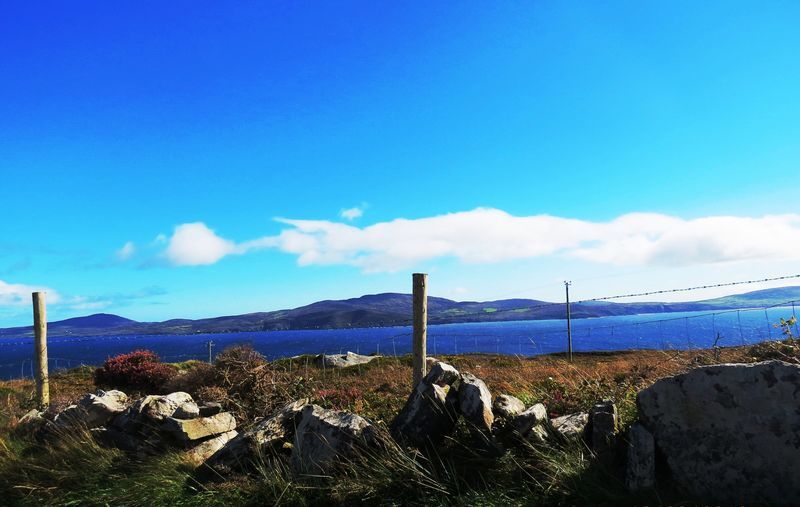
The main Sheep’s Head walk is about 93km long. It begins in the historic West Cork market town of Bantry. From there you hike right to the end of the Sheep’s Head peninsula where you’ll find the Sheep’s Head lighthouse and stunning views across West Cork’s bays and the Mizen and Beara peninsulas.
You might even be lucky enough to see dolphins and whales from the westernmost tip of the headland.
Varied Terrain

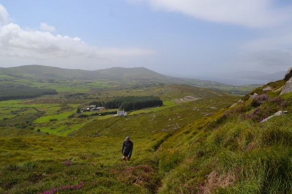
The terrain of the Sheep’s Head Way includes old boreens, open grassy paths, heathery hills, quiet roads, and some short stretches of woodland path. The peninsula has an interesting past: you’ll encounter remains of an old copper mine, a blow hole, stone circles, standing stones, high cliffs, a Napoleonic signal tower and old churches along the way.
When you return to Bantry, the Sheep’s Head Way walking route extends eastwards to Drimoleague and Gougane Barra. This route includes St. Finbarr’s Way, a magnificent pilgrim trail.
Whether you opt to hike the whole Sheep’s Head Way walking route or choose a shorter route that suits you, you’ll enjoy the peace and tranquility on offer in this stunning landscape.
The Sheep’s Head Way is divided into sections, and includes walks of varying lengths and levels of difficulty. You can pick Sheep’s Head Way loop walks, coastal trails, or a walk along the peninsula’s peaks to suit your mood and the time you have available.
The Drimoleague Heritage Walkways and the Carriganass Walks, linked to the Sheep’s Head Way, give you the opportunity to head inland to the West Cork hills.
Our experienced walking guides are available to lead groups: contact them to plan your trip. Details of scheduled tours are available on our events calendar for details of scheduled walks.
Sheep’s Head Way Maps & GPS Files
You’ll find files for your GPS devices and Google Earth below. GPS files for individual loop walks are included on their information pages.
Do get in touch if we can help you with any other aspect of planning your trip. We’ll be delighted to help.
| Download GPX Files for GPS Devices: | Download Sheep's Head Way GPX file |
| Download File for 3D View in Google Earth: | Download Sheep's Head Way KMZ file |
| Start/Finish: | Bantry West Trailhead |
| Grade: | Varies - parts easy, moderate, and difficult. |
| Distance: | 93 km |
| Estimated Time: | 5-6 days (based on average walking speed of 3km per hour) |
| Markers | Follow the Sheep's Head Way 'yellow walking man' markers |
| Metres Climbed/ Ascent: | 1626 metres |
| Maximum Height: | 236 metres |
| Dogs Allowed? | No |
| Minimum Gear: | Walking boots, rain gear, fluid, and a mobile phone. |
Sheep’s Head Way Main Route: Sections
| Route Sections | |
|---|---|
| Section 1 | Bantry To Boolteenagh |
| Section 2 | Boolteenagh to Glanlough |
| Section 3 | Glanlough to Seefin |
| Section 4 | Seefin to Cahergal |
| Section 5 | Cahergal to the Lighthouse |
| Section 6 | Lighthouse to Letter West |
| Section 7 | Letter West to Kilcrohane |
| Section 8 | Kilcrohane to Ahakista |
| Section 9 | Ahakista to Durrus |
| Section 10 | Durrus to Barnageehy |
| Section 11 | Barnageehy to Bantry |


