Living the Sheep's Head Way

  • The Sheep’s Head Way
  • Loop Walks
  • Accommodation
    • B&Bs
    • Hotels
    • Farmhouse Accommodation
    • Campsites

MENUMENU
  • Home
  • Things to Do
    • Walking
      • Sheep's Head Way Main Route
      • Loop Walks
        • Difficulty
          • Easy
          • Moderate
          • Hard
        • Time
          • Under 3 hours
          • 3-5 hours
          • 5 hours or more
        • Trailheads
          • Ahakista
          • Bantry West
          • Black Gate
          • Dún Óir
          • Durrus
          • Goat's Path
          • Kilcrohane
          • Tooreen
          • Whiddy Island
      • Walking Guides
    • Courses & Training
    • Crafts
    • Culture
    • Gardens
    • History
    • Cycling
    • Pony Trekking
    • Sailing & Kayaking
  • What's On
    • Events
    • Scheduled Courses
    • Festivals
  • Food
    • Cafés
    • Restaurants
    • Food Producers
    • Food Tours
    • Coeliac-Friendly
  • Where to Stay
    • B&B
    • Hotels
    • Self-Catering Holiday Homes
    • Farmhouse Accommodation
    • Campsites
    • Luxury Accommodation
    • Accessible Accommodation
  • News
  • How to Get Here
  • Location
    • Map
    • Ahakista
    • Bantry
    • Ballylickey
    • Drimoleague
    • Durrus
    • Kilcrohane
    • Whiddy Island
  • Services
    • Shops
    • Taxi Services
  • Contact Us
You are here: Home / Archives for Estimated Time: Under 3 hours

Gortnakilly Loop Walk | Sheep’s Head Way

February 5, 2014 by Dunmanus

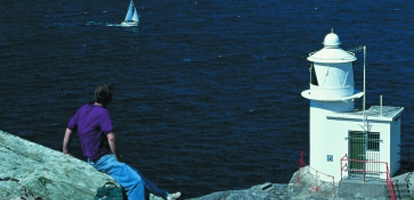
Take the Gortnakilly Loop Walk on the north side of the award-winning Sheep’s Head peninsula and enjoy stunning views across Bantry Bay

From the car park at Dún Óir on the north side of the peninsula, go over the timber stile way marker, Christian Cross no. 1. Follow the Mass Path way markers uphill until you reach The Mass Path Junction sign/ way marker no. 151.

Take the Sheep’s Head Way West Barán/Seefin option. Continue on until you reach The Windy Gap Junction sign/way marker no. 165 and take the Sheep’s Head Way West via the Goat’s Path option. Continue on down until you reach way marker no. 178.

At this point you will be walking down in a generally northerly direction until you meet the public road at way marker no. 190. Take a right turn here, and continue along the public road in a northeasterly direction and back to the car park at Dún Óir.
 

Download GPX file for GPS devices:File for Gortnakilly Loop Walk route
Start/Finish:Dún Óir Trailhead
Grade:Hard
Distance:7.9 km (approx)
Estimated time:2 hrs 45 mins (based on average walking speed of 3 km per hour)
Arrows:Orange arrows and follow the Mass Path Way markers (Christian Cross Symbol) until way marker no. 151. Then follow the main Sheep's Head Way yellow man markers.
Metres Climbed/ Ascent:302 metres
Maximum Height:270 metres
Dogs Allowed?No
Minimum Gear:Walking boots, rain gear, fluid, and a mobile phone.
Download file for 3D View on Google Earth:KMZ file for Gortnakilly Loop Walk route

Filed Under: Dún Óir Trailhead, Estimated Time: Under 3 hours, Hard, Sheep's Head Way Loop Walks, Walking

Cahergal Loop Walk

February 3, 2014 by Dunmanus

The Cahergal Loop Walk on the Sheep’s Head peninsula introduces you to the beauty and peace of an area recognised as a European Destination of Excellence

From the car park at the Black Gate and Alice West Centre past the village of Kilcrohane, follow the purple loop walk arrows for the Cahergal Loop Walk in a northeasterly direction along the public road for a short distance.

At way marker no. 3 (Peakeen, Cahergal and Caher), turn left off the public road. Continue up the track and onto the hill going through 4 stiles en-route until you reach way marker no. 15 (Peakeen and Cahir) and turn left.

Continue on, crossing the peninsula to the Bantry Bay side, until you reach the car park at Cahergal. Keep left after going over the timber stile and cross the road where you will go over another timber stile, passing way marker no. 206.

Continue straight on for the cove, passing the the ruins of a famine hamlet known locally as the “Crimea” and the abandoned copper mines, en route. At way marker no. 238, keep left and walk a short distance along the pubic road. Turn right at the finger post sign for “The Poet’s Way” and go off-road over a timber stile, at way marker no. 65 Poet’s Way/Cahergal. Follow the way markers to traverse the peninsula to the south side until you meet way marker no. 348.

Turn left here and continue straight on until way marker no. 354 and turn right. Continue on down to the public road and back to the Black Gate / Alice West Centre.
 

Download GPX file for GPS:Download Cahergal Loop Walk GPX file
Download file for 3D View on Google Earth:Download Cahergal Loop Walk KMZ file
Start/Finish:Black Gate Trailhead
Grade:Hard
Distance:8.4 km (approx)
Estimated Time:3 hrs (based on average walking speed of 3 km per hour)
Arrows:Purple
Metres Climbed/ Ascent:371 metres
Maximum Height:184 metres
Dogs Allowed?No
Minimum Gear:Walking boots, rain gear, fluid, and a mobile phone.

Filed Under: Black Gate trailhead, Estimated Time: Under 3 hours, Hard, Kilcrohane, Sheep's Head Way Loop Walks, Walking

Caher Loop Walk | Sheep’s Head Way

February 3, 2014 by Dunmanus

The Caher Loop Walk leads you up to the ridge of the Sheep’s Head peninsula, with fine views over Bantry Bay and Dunmanus Bay!

From the car park at the Black Gate / Alice West Centre just outside Kilcrohane village, follow the green loop walk arrows in a northeasterly direction along the public road for a short distance.

At way marker no. 3 (Peakeen, Cahergal and Cahir) turn left off the public road. Continue up the track and onto the hill going through 4 stiles en route until you reach way marker no. 17 marked Peakeen/Cahir.

Turn right down the hill beyond Cahir lake on an old road. When this road meets the public road turn left. Walk along the public road for a short distance then turning right downhill again onto “the stony roadeen” passing by a private garden.

Next veer right onto the public road again for a considerable distance. At way marker no. 368, veer right again walking in a southwesterly direction on the public road passing “The Cill” at Caher, a famine graveyard en route. The loop enters farmland at way marker no. 366 and descends towards the sea.

At Trá Rúaim strand, veer right uphill on the public by-road and right again when this road meets the main public road to return to The Black Gate.
 

Download GPX file for GPS:Download Caher Loop Walk GPX file
Download File for 3D View on Google Earth:Download Caher Loop Walk KMZ file
Start/Finish:Black Gate Trailhead
Grade:Hard
Distance:5.6 km (approx)
Estimated Time:2 hrs (based on average walking speed of 3 km per hour)
Arrows:Green Arrows
Metres Climbed/ Ascent:210 metres
Maximum Height:189 metres
Dogs Allowed?No
Minimum Gear:Walking boots, rain gear, fluid, and a mobile phone.

Filed Under: Black Gate trailhead, Estimated Time: Under 3 hours, Hard, Sheep's Head Way Loop Walks, Walking

Farranamanagh Loop Walk | Sheep’s Head Way

February 3, 2014 by Dunmanus

The Farranamanagh loop walk is a coastal trail that leads you from Kilcrohane village out along the edge of the Sheep’s Head peninsula

From The Old Creamery in Kilcrohane, walk in a northeasterly direction back up the peninsula following the red arrows and main Sheep’s Head Way ‘yellow man’ markers.

At marker no. 404, turn right off the main public road entering farmland. Continue on downhill to Farranamanagh strand and lake, walking beyond these and on uphill on rough ground beyond the Bardic School.

Farranamanagh loop walkThe school was home to O Dalys – chief poets to the O Mahony clan – and it was here on the coast of the Sheep’s Head peninsula that they passed the Irish poetic tradition from generation to generation.

Continue on to meet the main public road, turn left and you will arrive at Dromnea car park, way marker no. 425.

Here you can return directly to Kilcrohane village via the public road or continue on the loop by climbing the old stone stile to the left of the gate across the road.

Continue on uphill until you reach way marker no. 92 on the old Kilcrohane/Ahakista road. Continue straight on again until you reach way marker no. 01, veer left here for Kilcrohane, and continue on again in a southwesterly direction.

At way marker no. 10 follow the road down until you meet the main road. Take a right turn here and the main road will lead you back to Kilcrohane village, where a bite to eat at The Old Creamery will be a welcome reward for your walk!

The Farranamanagh Loop Walk is one of 20 loop walks along the Sheep’s Head Way Walking route on Ireland’s southwest coastline.


Download GPX file for GPSGPX file for Farranamanagh loop walk
Download to View in 3D on Google Maps:KMZ file for Farranamanagh loop walk
Start/Finish:Kilcrohane trailhead.
Grade:Moderate
Distance:6.1 km (approx)
Estimated time:2 hrs 15 mins (based on average walking speed of 3 km per hour)
Arrows:Red
Metres Climbed/ Ascent:236 metres
Maximum Height:110 metres
Dogs Allowed?No
Minimum Gear:Walking boots, rain gear, fluid, and a mobile phone.

Filed Under: Estimated Time: Under 3 hours, Kilcrohane, Kilcrohane Trailhead, Moderate, Sheep's Head Way Loop Walks, Walking

Lighthouse Loop Walk | Sheep’s Head Way

January 15, 2014 by Dunmanus

If you only take one loop walk along the Sheep’s Head Way, then take the lighthouse loop walk

It’s an exhilarating walk out to the very tip of the Sheep’s Head peninsula where you’ll get to take in stunning views over West Cork’s bays and peninsulas.

The Sheep’s Head Way is an 88km walking trail along the coastline of Ireland’s Sheep’s Head peninsula – a European Destination of Excellence – and the lighthouse loop walk is one of the best ways to experience the trail for experienced hikers and day trippers alike.

Sheep's Head lighthouse

Lighthouse Loop Walk Details

To begin your walk, drive down the Sheep’s Head peninsula until you reach the Cupán Tae tea shop. The road on the peninsula ends here at the Tooreen trailhead where your West Cork walk begins.

From the car park at Tooreen follow the blue loop walk arrows. Set out in a southwesterly direction on the Dunmanus Bay side of the peninsula. Your route leads you past rocky outcrops and Lough Akeen and brings to the lighthouse at the tip of the headland.

After the helicopter pad, the Sheep’s Head lighthouse comes into view and if you wish you can climb the concrete steps that lead up to it!

If you carry on around the peninsula’s north side, views open out over Bantry Bay and there are some spectacular sea cliffs alongside the trail.

The loop – one of 20 loop walks on the Sheep’s Head Way – returns on the Bantry Bay side and at the Daingean (fort) sign near waymarker no. 272, veer right here off the main route which leads you back to the Bernie’s Sheep’s Head café and the car park at Tooreen.

Note: Be aware of weather conditions, unprotected dangerous cliffs and cut away peat bogs along the loop walk. Please do not exit marked trails only on marked routes. No dogs are allowed on The Sheep’s Head Way.
 

No trip to this walk is complete without a pause at Bernie’s Cupán Tae!

Download GPX File for GPS:Lighthouse Loop Walk file for GPS
Download file for 3D view in Google Earth:KMZ file for Lighthouse Loop Walk
Start/End Point;Car park at the end of the road on the Sheep's Head peninsula.
Difficulty:Moderate
Length:4.2 kilometres
Time:1.5 hours (approx)
Arrows:Blue
Metres Climbed:304 max.
Height:185m
Terrain:Footpaths, tracks and paved lanes. Steps down to the lighthouse, and close to cliffs.
Facilities:The walk begins and ends at the Cupán Tae tea shop.
Car park and toilet facilities are available here.

Filed Under: Estimated Time: Under 3 hours, Moderate, Sheep's Head Way Loop Walks, Tooreen Trailhead, Walking

Whiddy Island Loop Walk

January 5, 2014 by Dunmanus

Whiddy Island Loop Walk
Whiddy Island Treasure Hunt

Take a walk on Whiddy Island – one of West Cork’s seven inhabited islands!

Whiddy Island is situated in Bantry Bay between the Beara and Sheep’s Head peninsulas, and it’s home to a walk that offers spectacular views across Bantry Bay and the neighbouring landscapes.

Whiddy Island Ferry

Whiddy Island Walk Details

From the Bantry West trailhead, set out along the N71 to the pier and take the Whiddy Island Ferry. The trip over Bantry Bay gives you a stunning view of Bantry House, and takes approximately 20 minutes, depending on weather conditions.

From the Whiddy Island Trailhead set out along the road. At the T-junction take a left at the finger post sign taking the Tranaha option. At the next way marker take a right over a timber stile and continue off-road uphill along a path. At the second timber stile, you will begin to descend the hill. You will encounter two more timber stiles before re-joining the road again at the fourth timber stile and continue on to your right.

From here on follow the road and way markers back to the trailhead, and maybe take a moment to stop at the Bank House pub before you make your way back to Bantry.
 

Please note the seasonal ferry times to Whiddy Island before setting out from the pier at Bantry.

Start/Finish:Whiddy Island Trailhead
Grade:Moderate
Distance:1.6 km (approx)
Estimated time:1 hour (based on average walking speed of 3 km per hour)
Metres Climbed/ Ascent:75 metres
Maximum Height:40 metres
Dogs Allowed?No
Minimum Gear:Walking boots, rain gear, fluid, and a mobile phone.

Filed Under: Estimated Time: Under 3 hours, Moderate, Walking, Whiddy Island, Whiddy Island Trailhead Tagged With: Moderate

Wild Atlantic Way

What’s On

No event found!

Visit Historic Places

Bantry House B&B

The Sheep’s Head is a peninsula rich in history and you’ll find traces of its past all along the Sheep’s Head Way walking route.

Find out more

Pure cork

Featured Activity

Cycling Sheep's Head peninsula

Bike Hire at Kilcrohane Creamery

Hire a bike in Kilcrohane and start exploring the coastline of the Sheep’s Head peninsula – one of the most unspoilt stretches of Ireland’s Wild Atlantic Way touring route Traditional and electric bikes are now available for hire in Kilcrohane, so everyone has the chance to experience cycling along a stretch of the Sheep’s Head […]

More Activities

Featured Accommodation

Dromcloc House

Dromcloc House

Dromcloc House is a family-owned Bed & Breakfast set on a seaside dairy farm at Relane Point on the Sheep’s Head peninsula Dromcloc is situated just 4km from the historic market town of Bantry, and the renowned Sheep’s Head Way walking route passes its door. Dromcloc House overlooks Bantry Bay, and the sea views, with […]

More Accommodation

This project has been supported by Cork County Council & the LEADER programme under the Rural Development Programmes 2007-13 and 2017-2021.
  • The Sheep’s Head Way
  • Loop Walks
  • Accommodation
Sheep's Head & Bantry Tourism Cooperative, copyright 2018 | Website by Wordhoard Communications